Royal Palms Directions

Royal Palms Beach, Los Angeles County, California

Royal Palms Directions


map of Royal Palms Beach area and  the Palos Verdes Peninsula, Los Angles, California

Mileages and Driving Times to Royal Palms Beach


City Miles Hrs/Mins
Bakersfield 133 2:10
Escondido 106 1:43
Fresno 241 3:48
Las Vegas, NV 29o 4:22
Long Beach 7 0:20
Los Angeles 25 0:30
Newport Beach 42 0:49
Palm Springs 123 2:06
Pasadena 34 0:42
Paso Robles 247 3:55
Phoenix, AZ 386 5:44
San Bernardino 78 1:18
San Diego 123 2:02
San Jose 363 5:46
San Luis Obispo 220 3:28
San Francisco 404 6:08
Santa Barbara 115 1:53
Ventura 87 1:27

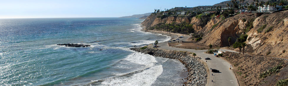
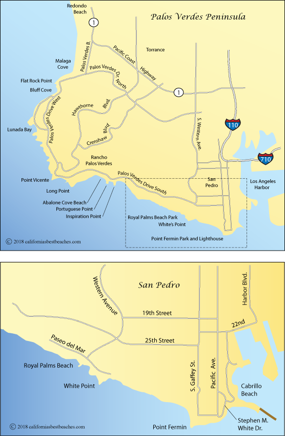
Directions to Royal Palms Beach and Pt. Fermin

With the landslide along Paseo del Mar still not repaired, for most people the best approach to Royal Palms Beach is to travel south on Western Avenue to Paseo del Mar. Then turn left and watch for nearby parking.

For Point Fermin, coming from Royal Palms Beach, bypass the landslide by going north on Western Avenue and then east on 25th Street to Gaffey Street. Follow Gaffey Street south to Point Fermin. Coming from the north take the Gaffey Street exit off Interstate 110.