Morro Bay Beaches
Morro Rock Beach
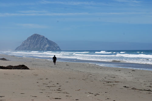
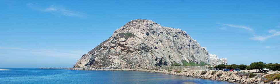
Morro Rock Beach (or Morro Bay Beach) is immediately north of Morro Rock, within the city limits of Morro Bay. The beach is popular for its dramatic setting with Morro Rock looming nearby. During the summer two lifeguard towers are staffed from 10:00 AM to 6:00 PM. Morro Rock Beach is not park of the state park.
Swimming, surfing, sandcastle building, sun bathing, and picnicking are all favorite activities there. Fires are not allowed on the beach and dogs must be on leash. The beach is open from dawn to dusk.
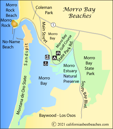
Coleman Park Beach
Coleman Park extends along the waterfront at the northern end of the Embarcadero, just east of Morro Rock. The park includes a picnic area, BBQ pits, restrooms, and a children's play area. Visitors enjoy watching ocean wildlife and birds there.
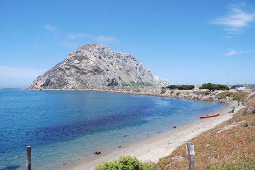
Coleman Park Beach
Sandspit
Sandspit extends nearly 4 miles along the coast from the mouth of Morro Bay to Montana de Oro State Park. This dune barrier separates Morro Bay from the Pacific Ocean. Some of the dunes rise to 100 feet. The ocean side of Sandspit is too dangerous for swimming, with sudden drop-offs and dangerous rip-currents.
Sandspit can be accessed from the south via Los Osos Valley Road and Sand Spit Road. Some visitors paddle across the bay by kayak or other boats. The area is protected as part of the Morro Dunes Natural Preserve. Parts of the Sandspit are nesting areas for endangered Snowy Plovers.
No-Name Beach
This little patch of sand is tucked in at the foot of Morro Rock between the breakwater and the parking lot at the end of Coleman Drive.
Spooner's Cove in Montana de Oro State Park
Spooner's Cove, in Montana de Oro State Park, has a secluded pebble beach surrounded by rugged rock outcroppings and high bluffs. Look for the hole-in-the-rock and caves. Watch out for the incoming tide. The beach has small bits of sea glass and colorful rocks. Surfers like the break here, including one spot - South Point - known for its huge waves. Kayakers often launch from the cove.
Access is via Pecho Valley Road off Los Osos Valley Road at the south end of Morro Bay. The old Spooner ranch house just above the cove serves as the park headquarters. A visitor center is open daily during the summer and on weekends the rest of the year. Picnic tables and firepits are found at the cove along with restrooms. Parking is free by the park headquarters.
Morro Bay Birds
Morro Bay is an important stop for birds migrating along the Pacific Flyway. The bay provides seasonal roosting and feeding grounds for more than 100 species of migratory birds. Along the point north of the museum are groves of eucalyptus and cypress trees which provide habitat for a variety of birds, including great blue herons, great egrets, and double-crested cormorants. Out on Morro Rock you may spot a nesting pair of peregrine falcons.